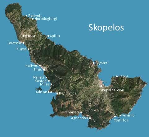
Geography of Skopelos
Geography Skopelos, The Skopelos Geography, geography of Skopelos Island, Northern Sporades, mountains, physical geography, natural environment, Skopelos Map, Greece
GEOGRAPHY OF SKOPELOS
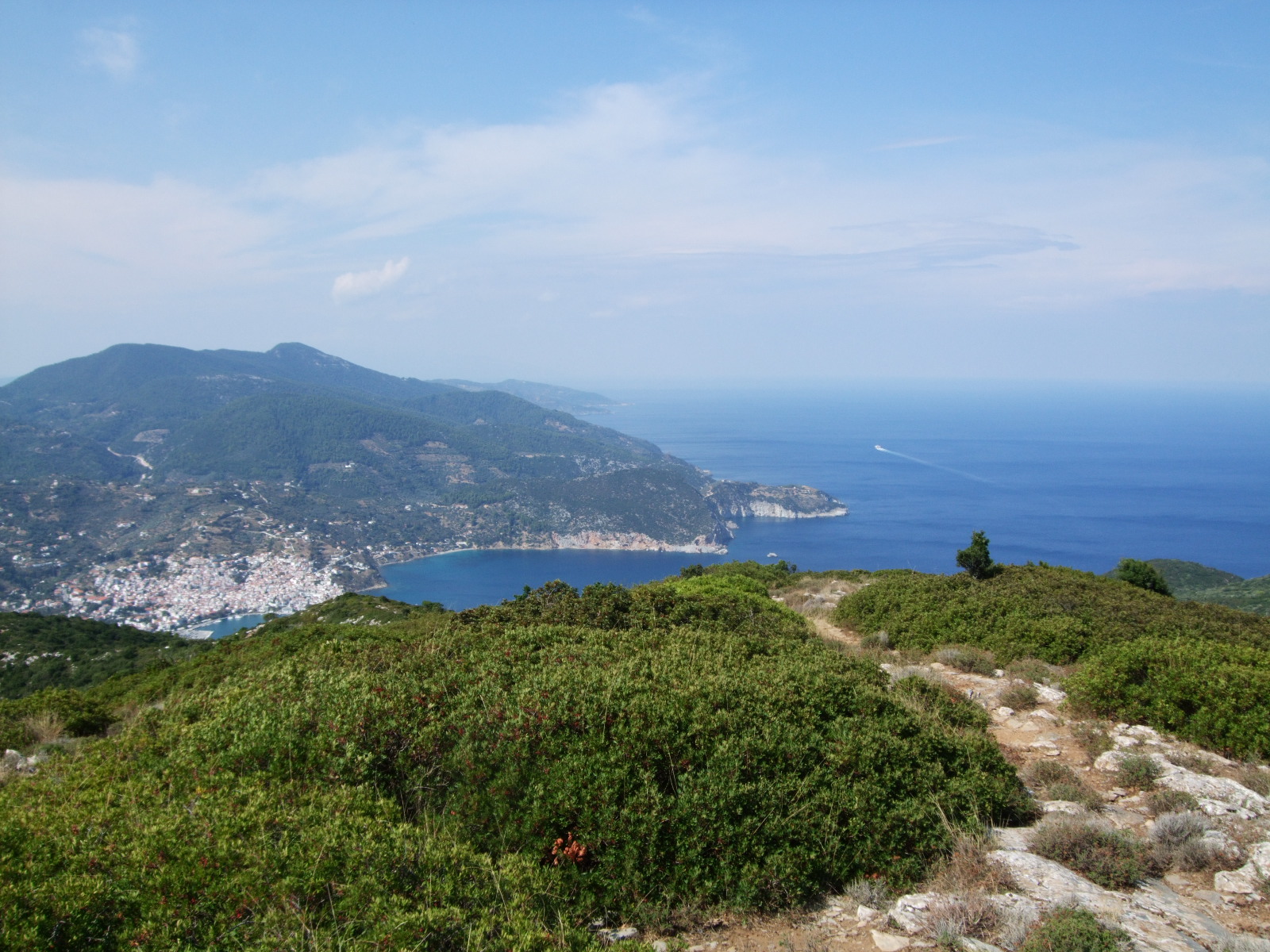
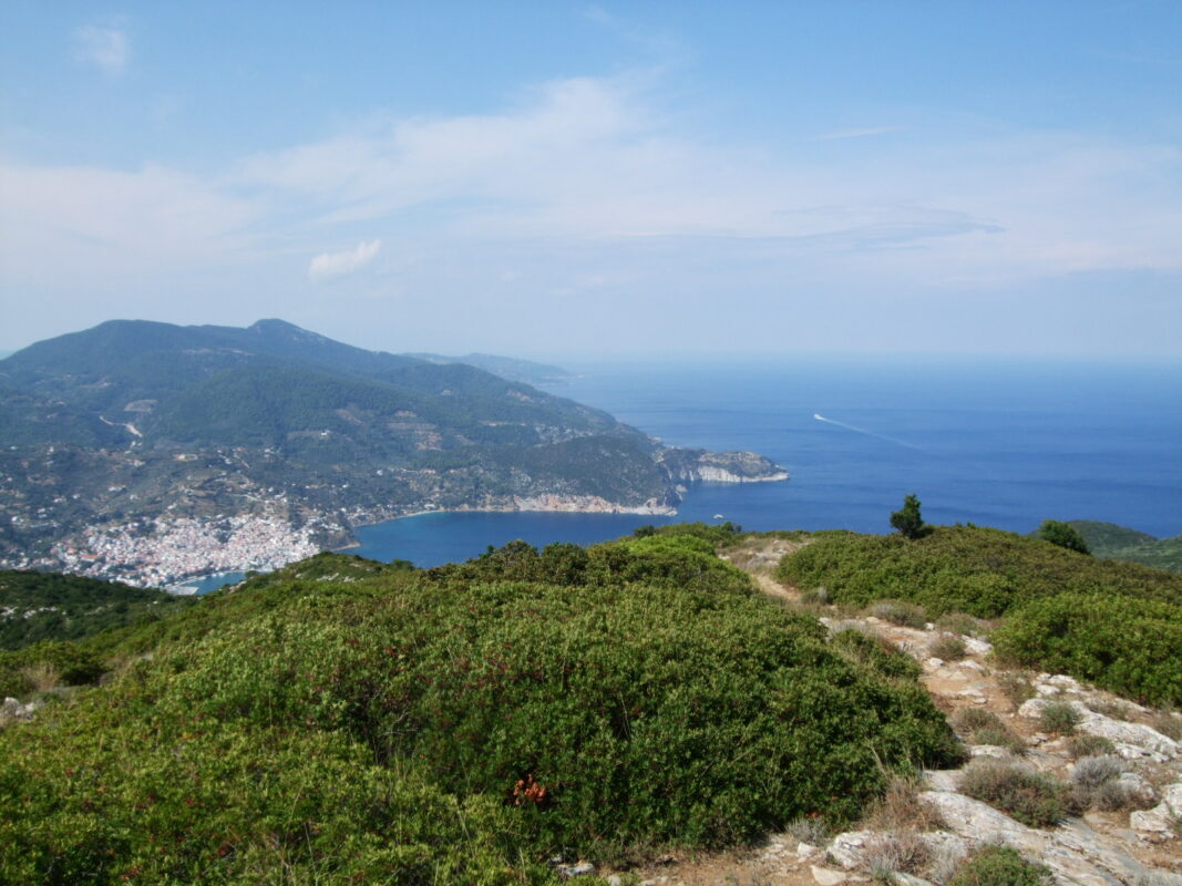
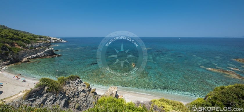
Skopelos is a North-West Aegean Island, east of Skiathos and west of Alonnisos. It has a lengthy narrow shape with an extent of 95.8 sq. km. a coast perimeter of 67 km, a maximum length of 17 km, and a maximum width of 8 km. Skopelos is one of several islands which comprise the Northern Sporades island group. Due to the island’s mountainous terrain most of the coast is inaccessible. Visitors of Skopelos will discover the numerous private beaches of Skopelos Island, in Sporades, Greece, most of which are accessible by boat or via small and difficult paths.
Its population is almost 6000 residents; it is the biggest island of the Northern Sporades.
The island belongs to the province of Magnesia and it has one municipality. Skopelos Municipality contains the same named market town, Glossa and Neo Klima ( Elios). The municipality has an area of 96.299 square kilometers
MOUNTAINS OF SKOPELOS
Skopelos has a mountainous bas–relief and the coasts are rocky. The biggest bays are the bays of Skopelos, where a port is also, Agnontas and Panormos. Cliffs steeply fall into the sea in the greatest part of the coast. Mountains dominate the western and eastern parts of the island. There are two mountains over 500 m; Delphi (681 m) in the center of the island, and Palouki (546 m) in the southeast. The main port of Skopelos can sometimes be closed due to weather conditions since it is placed on the north part of the island. The smaller bays of Staphylos, and Agnontas on the south coast, and Panormos on the west offer better protection.
Climate of Skopelos
The Climate of Skopelos is mild and healthy. The island has rich sprouting with pine trees, olive trees, almond trees, plum trees and vineyards
Understanding Skopelos Island’s Geography
Skopelos, the largest island in the Northern Sporades archipelago, boasts a diverse terrain characterized by verdant pine forests, pristine beaches, and rugged cliffs. Its strategic location in the Aegean Sea grants it a mild Mediterranean climate, making it an alluring destination year-round. The island’s geography is intricately woven into its cultural fabric, with each corner harboring tales of ancient civilizations and modern-day traditions.